About the Locations
Explore the various locations around Ecuador and Peru that are part of the narrators’ lives

Puno, Peru
Nestled on the shores of Lake Titicaca, the world’s highest navigable body of water, Puno is the folkloric capital of Peru, known for its vibrant festivals, rich history, and stunning high-altitude landscapes. The region's Indigenous peoples have thrived through fishing, agriculture around quinoa and potatoes, and crafting intricate textiles and handicrafts that reflect their deep cultural heritage, practices which they still utilize to drive the local economy today. Home to the famous Uros floating islands, Puno offers a unique blend of history, tradition, and breathtaking natural beauty.
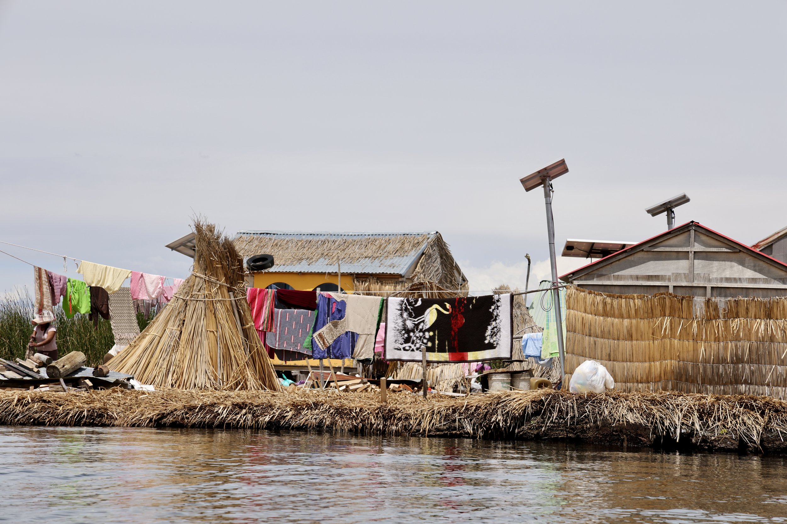
Uros, Lake Titicaca, Peru
The Uros Islands are a group of artificial floating islands on Lake Titicaca, inhabited by the Uros people, an Indigenous group with a history that predates the Inca civilization. These islands are constructed entirely from totora reeds, a versatile plant that grows abundantly in the lake. Totora plays a vital role in Uros life-it is used not only to build and maintain the islands but also to construct their homes, boats, and even for food and medicine. The islands require constant upkeep, as the reeds at the bottom decompose over time and must be replenished regularly with fresh layers on top. The Uros people have mastered this technique, passing it down through generations.
Visitors to the Uros Islands can experience this unique way of life firsthand, learning about traditional fishing techniques, reed weaving, and the deep cultural significance of totora. Despite modernization, many Uros families continue to preserve their traditions, offering a fascinating glimpse into a centuries-old way of life that remains intricately tied to Lake Titicaca.


Guaranda, Bolivar, Ecuador
Guaranda is in a valley of the central Andes region of Ecuador in the Bolivar province, with a population of 55,374 and at an altitude of 8,753 feet. The city was officially founded by Spanish settlers in 1751. In 1811, the new settlers of the town and the original inhabitants of the land proclaimed their independence from Spain. Today, the region remains agrarian, now settled by mostly Quechua indigenous and mestizo individuals. Most elected officials and other positions of leadership are of Quechua descent. Many farmers here either live in Guaranda or come to Guaranda to sell their crops, but their finca (farm), are in the region, but further out. The main crops of the country are maize, potatoes, rice, plantains, and bananas, many of them holding important cultural meanings to those who grow them.
The growing town is surrounded by seven hills and the Chimborazo Volcano, the tallest peak in Ecuador, which overlooks the town and is visible on most days.
Santa Fe, Bolivar, Ecuador
Santa Fe is located 5 kilometers outside of Guaranda. Santa Fe is mostly populated by indigenous agrarian communities, with families and their farms dispersed in the vicinity. Santa Fe is its own Catholic parish, and the town center has grown exponentially over the years. Although lack of access to education and other resources affected many farmers in the past, today Guaranda is a bustling growing city with education through high school, a hospital, clinics, and other community resources.
The snow-capped mountain seen in the image is the Chimborazo Volcano, the closest point from the Earth’s core to the sun. Chimborazo has been vital in the agrarian identities of individuals who live in its presence, and acknowledgement of a changing climate takes place in the described imagery of community members mentioning that there is less and less snow in the volcano from where they farm.
